Geospatial topology is the concept of rules affecting the relationships between the points, lines, and polygons that represent the land features of a geographic region. For example, where two polygons represent adjacent counties or line segment represent trail network.
A trails network topology will be represented by line segments properly connected together. Each trail start at an intersection node, end finished on another trail intersection node or on a dead end.
In the next example, nodes are represented by purple points and dead end by orange point. A clean topology network is nicely attache together and each line segment starts and finished their path by sharing the exact same node of another trail line segment. All network nodes represent an intersection.
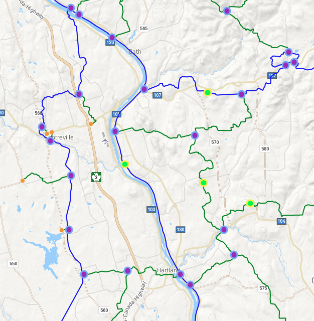
Trails network topology
How bad topology affect my Trails application
All trails apps will be affected by a bad network topology. The most common errors will be a bad path routing result on the map or too many steps in "Turn by turn" description list. This is mainly due to three things:
1) Network Gaps (affect map path routing)
2) Network pseudo nodes (green point and affect turn by turn description)
3) Network Dead end (orange point and most of the time have no effect on routing)
For a better understanding of what looks like each of those topologies issues, here's some example:
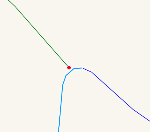
Example of Network Gap
How to fix topology gap issues
To fix topology gap issues, open your Trails - Manager app in your account and click on the pencil icon on your extreme right. Then press CTRL button (Mac iOS user click on CMD button) en draws a rectangle with your mouse pointer to select each segment affected by the topology issue. Then select each of them and move end/start line segment on the same node and click "Save and Close" button. This will fixe the gap issue.
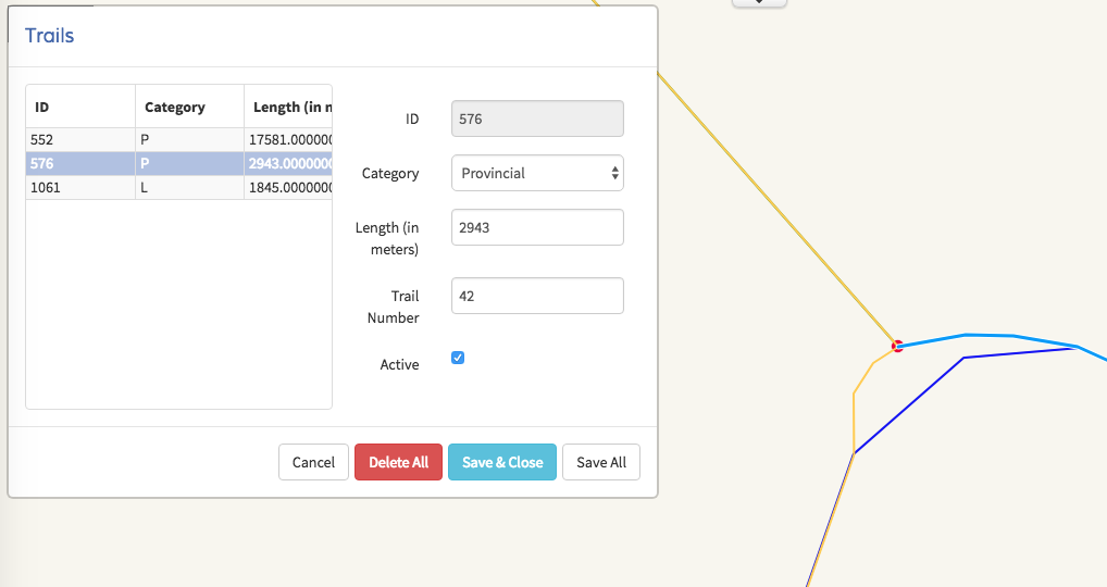
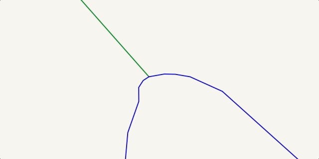
The final result will be much better and will produce a nice routing path for your users. Each end/start line segment share the exact same node and define a network intersection.
How to fix topology pseudo node issues
The only way to fixe those issue is to delete the smaller line segment representing the same trail and extended the other line segment on the intersection node.
0 Comments